

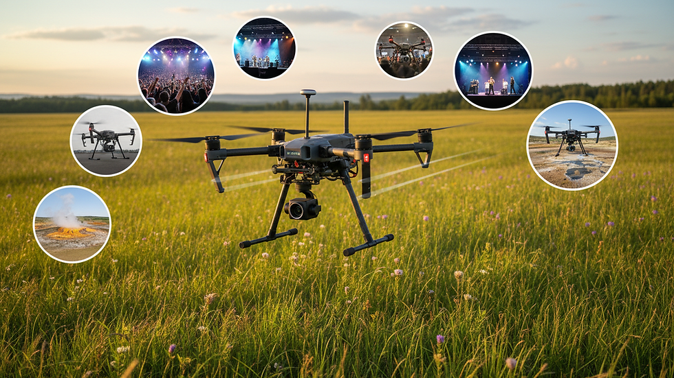
A Practical Guide to UAV Real Estate Photography
- Ryland Kruk

- Jul 11, 2025
- 13 min read
What is UAV real estate photography? In simple terms, it's using a drone to capture stunning aerial photos and videos of a property. It’s about going beyond ground-level shots to tell a more complete story. This method showcases a home’s best features, its layout, and the surrounding neighborhood in a single, compelling view.
The Unmatched Advantage of UAV Photography
Why are so many real estate agents turning to drones? Because UAV real estate photography provides a powerful edge that standard photos can't match.
Imagine you're listing a home with a gorgeous, landscaped backyard and a brand-new roof. A photographer on the ground would struggle to capture the full beauty and scale of these features.
But with an Unmanned Aerial Vehicle (UAV), or drone, you can soar above the property. This bird's-eye view instantly highlights key selling points. You’re not just showing a house; you're selling a lifestyle and its place in the community. This perspective helps build an emotional connection with buyers before they even visit.
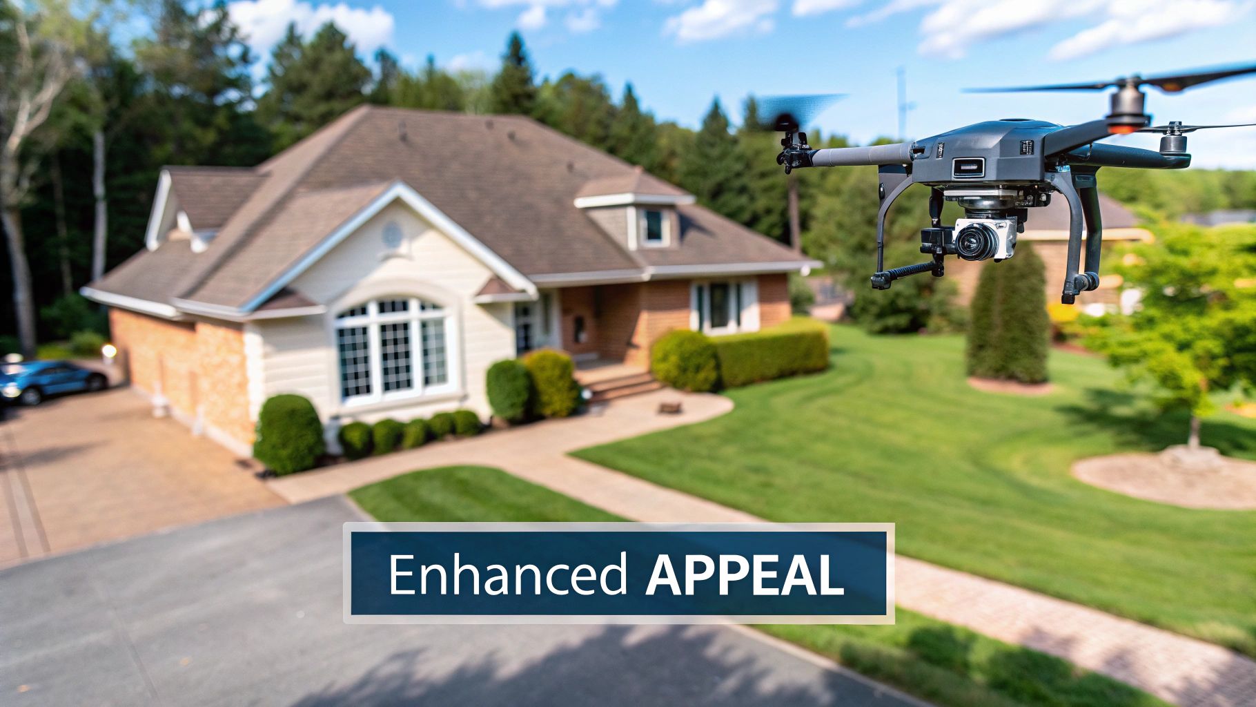
Creating a Powerful First Impression
In a crowded real estate market, first impressions are everything. Listings with professional, eye-catching visuals get more clicks, more engagement, and more serious buyers. UAV photography delivers that crucial "wow" factor.
A sweeping aerial video or a dramatic twilight shot from above can stop a potential buyer mid-scroll. It instantly communicates value, professionalism, and attention to detail, which often translates into a higher perceived value for the property.
Translating Views into Faster Sales
This enhanced appeal directly impacts how quickly a property sells and for how much. The trend is clear, especially in competitive markets. For example, an estimated 80% of active listing agents in California now use drone photography.
The data speaks for itself. Listings with aerial imagery sell, on average, 68% faster than those without. On top of that, these properties can command a price premium of up to 10%. This shows how effectively drone shots showcase a home's full value.
Widespread adoption means aerial visuals are no longer a gimmick—they're becoming the standard for effective property marketing. By giving buyers a complete and flattering view, you empower them to make faster, more confident decisions.
To learn more, see how this works in practice by exploring the benefits of aerial photography. This approach helps you secure serious offers and stand out from the first click.
UAV Photography vs Traditional Photography at a Glance
Let's break down the key differences between ground-based photos and aerial shots. This quick comparison shows why UAV photography is a game-changer for real estate listings.
Feature | Traditional Ground Photography | UAV Aerial Photography |
|---|---|---|
Perspective | Limited to eye-level and tripod height | Offers dynamic bird's-eye and high-angle views |
Property Context | Shows immediate surroundings only | Displays the entire property, lot size, and neighbourhood |
Key Features | Struggles to capture large features like roofs or big yards | Highlights pools, landscaping, and acreage effectively |
Buyer Engagement | Standard, can blend in with other listings | High "wow" factor, stops scrolling and increases clicks |
Storytelling | Tells a limited, room-by-room story | Creates a comprehensive narrative of the home and lifestyle |
While traditional photos are still vital for interiors, UAV photography provides the context and visual punch needed to grab a buyer's attention right away.
Visualizing the Data-Driven Advantage
The impact of aerial imagery isn't just a feeling; it's backed by data. The numbers below show how much drone photos influence buyer decisions, boost engagement, and even improve cost efficiency.
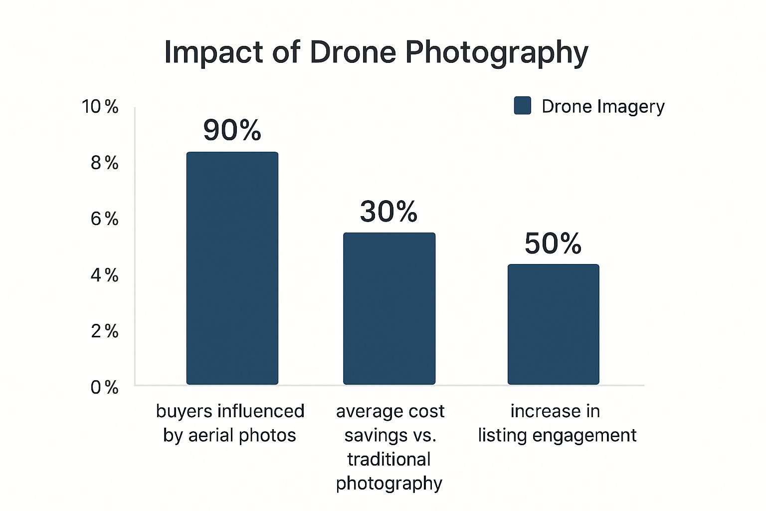
This data makes it clear: using drones isn't just about pretty pictures. It's a smart marketing decision that significantly improves a listing's performance.
Understanding Your Investment and ROI
When considering professional UAV real estate photography, your first thought is likely about the cost. That's natural. But a better question is, what's the return on that investment?
Think of aerial imagery not as an expense, but as a marketing tool. A smart investment here can lead directly to faster sales and stronger offers. It's about spending strategically to make a big impact on the final sale price and get the property sold sooner.
Breaking Down the Costs of Drone Photography
The price for UAV real estate photography varies. It depends on what your listing needs to stand out, so you only pay for what will make a real difference.
A few factors influence the cost:
Property Size and Acreage: Larger properties take more time and more photos to capture fully. A suburban home has different needs than a sprawling country estate.
Project Complexity: A basic set of aerial photos costs less than a full package with a cinematic video, multiple flight paths, and detailed editing.
Location and Accessibility: A remote or hard-to-reach property might involve extra travel costs or more complex flight planning.
Because of these variables, pricing is flexible. You can choose an essential photo package for a standard home or a full video production for a luxury property. For a deeper dive, read our [cost and quality analysis of drone photography services](https://www.dronephotographybyryland.com/post/cost-and-quality-analysis-of-drone-photography-and-traditional-photography-services-in-calgary).
Real-World Pricing Examples
To give you a clearer idea, let's look at typical costs. In a competitive market like California, photography packages are often tiered, with drone services included for mid-range and luxury homes.
For smaller properties, a basic package of 15 to 25 images usually costs between $150 and $300. For more coverage, a standard package with 30 to 50 images—often mixing ground and aerial shots—is typically in the $300 to $500 range. For high-end luxury listings, packages can start at $500 and exceed $1,500, depending on the home and photographer.
This shows there’s a professional photography solution for almost any property and budget.
Calculating Your Return on Investment
Now, let's connect those costs to the payoff. UAV real estate photography more than pays for itself by helping sell a property faster and for a higher price. This makes the initial photography cost a small but effective part of your marketing budget.
A modest investment in high-quality aerial photos can directly influence buyer perception, often leading to offers that are thousands of dollars higher than they might have been otherwise. This makes the return on investment incredibly high.
Think of it this way: if spending $400 on a photo package helps a property sell a month faster, you've saved the seller significant carrying costs. If that same package helps bring in a final offer that’s $5,000 higher, the ROI is crystal clear.
Stunning visuals create an immediate impression of value, which encourages buyers to become more competitive. This competition is what drives up the final sale price, turning the photography fee into one of the smartest moves you can make for a listing.
Navigating Drone Regulations in Canada
Flying a drone for business in Canada requires following rules set by Transport Canada. Hiring a non-compliant pilot for your UAV real estate photography can lead to serious legal and financial problems.
Think of these regulations like traffic laws for the sky. You wouldn't hire an unlicensed driver, and the same logic applies here. These rules exist to ensure every flight is safe and professional.
Basic vs. Advanced Pilot Certificates
Transport Canada has two main pilot certifications, and the one a pilot needs depends on where they fly. Knowing the difference helps you find a trustworthy partner.
The two certificates are:
Basic Operations: For flying in uncontrolled airspace, away from people. This is suitable for large rural properties where the drone stays at least 30 metres from bystanders.
Advanced Operations: This is essential for most real estate work. A pilot needs this certificate to fly in controlled airspace (like near airports, with permission) and closer to people, which is necessary for homes in residential neighborhoods.
For almost every urban or suburban listing, your drone pilot must hold an Advanced Operations Pilot Certificate. This proves they have passed a tougher exam and a hands-on flight review, showing they can safely manage flights in populated areas.
The Importance of Aircraft Registration
This is non-negotiable. Every drone used for business weighing between 250 grams and 25 kilograms must be registered with Transport Canada. The drone must be marked with its unique registration number.
Think of it as a license plate for the drone. It ensures accountability and safety. When hiring a professional, always ask for proof that their drone is registered for commercial use.
To help pilots comply, Transport Canada offers an online tool. The screenshot below shows the first questions a pilot answers to determine which rules apply.
This tool helps a pilot quickly confirm if their flight falls under Basic or Advanced Operations, so they follow the correct rules.
Questions Every Agent Should Ask Their Drone Pilot
To protect your business and ensure compliance, ask these questions before hiring anyone. A true professional will gladly provide straight answers and show you their documents.
Here’s your simple checklist:
What level of Pilot Certificate do you hold? For most real estate jobs, the answer must be "Advanced." Ask to see the physical certificate.
Is your drone registered with Transport Canada? They should provide the registration number for the drone they plan to use.
Do you carry liability insurance? A professional must have at least $100,000 in liability insurance. Ask for proof of insurance.
Peace of mind comes from knowing your UAV real estate photography is not only beautiful but also 100% legal and insured. Taking a few moments to verify a pilot’s credentials protects you from liability and reinforces your reputation as a thorough and professional agent.
Being informed helps you pick a UAV partner who works safely and by the book, getting you incredible aerial shots without any surprises.
How to Get Breathtaking Aerial Shots
We've covered the rules, now for the creative part. This is where the magic of UAV real estate photography truly happens.
Getting unforgettable aerial photos and videos is a mix of art and science. It requires careful planning around light and weather, combined with a storyteller's eye for what makes a property special.
The goal isn't just to fly a drone around a house. It's to create a visual story that draws a buyer in, highlights the home's best features, and makes them feel an instant connection. It’s about turning a simple listing photo into a compelling reason to book a showing.
Master the Light and Weather
The single most important element for great outdoor photography is light. The time of day you schedule a shoot completely changes the final images. Harsh midday sun creates deep, unflattering shadows and washes out colors, making even a beautiful home look flat.
This is why professionals love the "golden hour." This is the period shortly after sunrise or before sunset when the sun is low in the sky, casting a soft, warm glow. This light is incredibly flattering—it minimizes harsh shadows, enhances colors, and gives the property a beautiful sense of depth.
Weather is also a key factor. An overcast day can be useful, as clouds act like a giant softbox, creating even, gentle light. However, high winds, rain, or storms are definite no-gos. It's unsafe to fly, and the footage will be shaky. Always reschedule in bad weather.
Dialing in the Perfect Camera Settings
A professional pilot never uses "auto" mode. To get crisp, vibrant, professional-grade photos, they must take manual control of the camera. While this is the pilot's job, understanding the basics helps you appreciate the skill involved.
It comes down to a few key settings:
Low ISO: Keeping the ISO (the camera's light sensitivity) low, usually at ISO 100, prevents grainy "noise" and keeps images clean and sharp.
Aperture: A mid-range aperture, around f/4 or f/5.6, is often the sweet spot. It ensures everything from the front yard to the back fence is in sharp focus.
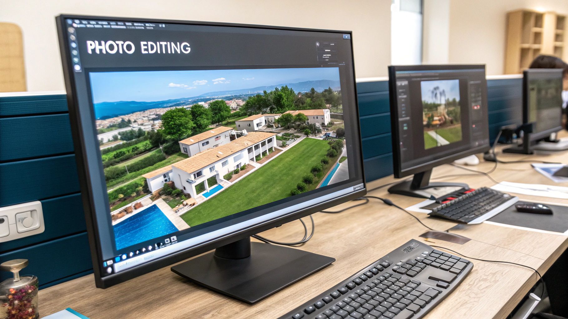
Shooting in RAW: Pros always shoot in RAW format, not JPEG. RAW files contain much more image data, which allows for greater flexibility in post-production to adjust colors and lighting without losing quality.
These technical details separate a quick snapshot from a professional photograph ready to sell a property.
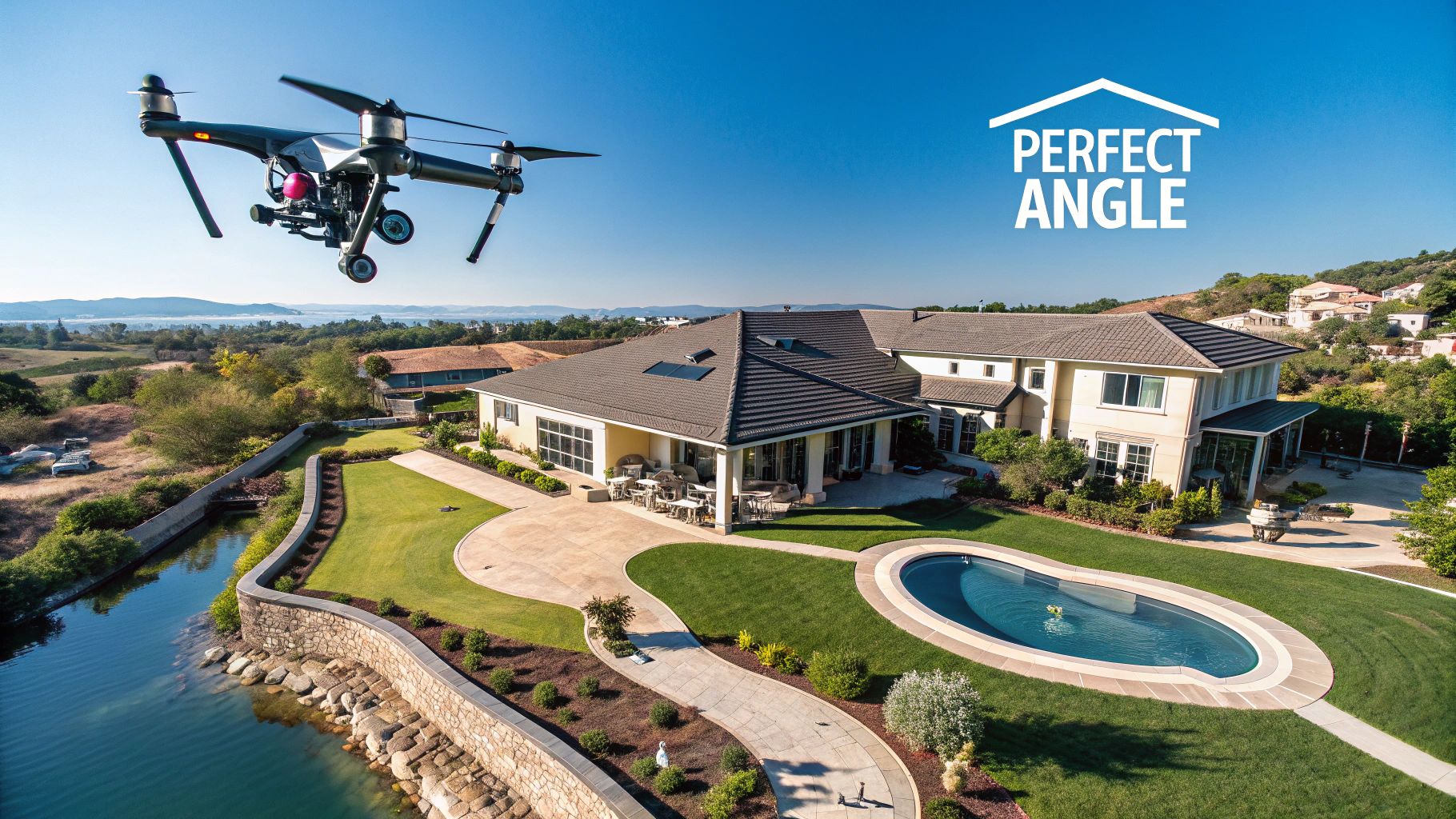
Composing Shots That Tell a Story
Beyond the technical settings, the real art is in the composition. Every shot should have a purpose. It should be planned to highlight a specific feature or tell part of the property's story. It's about helping buyers see more than a house; you want them to picture their life there.
Drones capture incredible angles impossible from the ground. We can showcase the roof's condition, the yard's layout, and the surrounding neighborhood all at once. This visual impact grabs buyers' attention, drives more viewings, and helps close deals faster. For an extra touch, twilight drone photography creates an enchanting mood that makes a listing stand out. You can discover more insights about real estate marketing with drones on aeroviews.co to see how these techniques elevate a property.
A great aerial shot does more than just document a property; it evokes an emotional response. By framing the home in its best possible light and context, you help buyers envision their future there.
Here are a few powerful shot types we use often:
The Reveal Shot: The drone starts low or behind an object like trees, then slowly rises to dramatically reveal the home, creating a "wow" moment.
The Top-Down View (Nadir Shot): A straight-down shot from above is perfect for showing off lot size, a beautiful pool, a large deck, or gardens.
The Orbit Shot: The drone flies a smooth circle around the property, providing a 360-degree tour of the house and its grounds.
The Neighbourhood Context Shot: Flying higher captures a broader view of the home's location, showing its proximity to parks, schools, or a waterfront.
Choosing the Right UAV Photography Partner
Your final results depend entirely on the professional you hire. Now that you understand the potential of UAV real estate photography, the next step is finding a qualified partner. This isn’t just about finding someone with a drone; it’s about choosing a skilled operator who will make your listings shine while working safely and legally.
Choosing the right partner is a critical business decision. A true professional provides reliability, peace of mind, and images that get results. A poor choice can lead to mediocre visuals, legal issues, and a missed marketing opportunity.
Your Vetting Checklist
Use this simple checklist to separate the pros from the hobbyists. Any reputable pilot will have no problem providing clear answers and documents.
Here are the non-negotiables:
Transport Canada Certification: This is mandatory. For most real estate work, the pilot must hold an Advanced Operations Pilot Certificate. Ask to see it.
Liability Insurance: Your partner must carry specific drone liability insurance. A minimum of $100,000 is the legal standard, but top professionals carry more.
A Strong Real Estate Portfolio: Review their past work. A gallery full of high-quality real estate examples is the best proof of their skill and experience.
If a pilot is hesitant to provide any of this information, consider it a major red flag and look elsewhere.
Key Questions to Ask About Their Process
Once you’ve confirmed the basics, ask about their workflow and technical skills. Their answers will reveal their professionalism and what you can expect from the final product.
A professional's process is just as important as their equipment. Understanding their approach to shooting and editing ensures the final visuals will align perfectly with your marketing goals and brand standards.
Ask about their editing process to see how they bring images to life. For agents building a comprehensive marketing strategy, understanding how expertly edited visuals fit into a broader campaign is key. Thinking about [revamping real estate marketing through aerial views](https://www.dronephotographybyryland.com/post/revamping-real-estate-marketing-through-aerial-views) can provide valuable context here.
Spotting Common Red Flags
Knowing what to watch for can save you a lot of trouble. Keep an eye out for these warning signs when searching for a UAV photography partner.
Unusually Low Prices: If a quote seems too good to be true, it probably is. This often indicates a lack of insurance, proper certification, or experience.
Lack of a Professional Portfolio: If they only have hobbyist photos, they likely don't have the specialized experience real estate marketing requires.
No Mention of Safety or Regulations: A true professional prioritizes safety and will openly discuss how they comply with Transport Canada rules.
By following this guide, you can confidently choose a UAV partner who will deliver safe, legal, and stunning aerial imagery that helps your listings get the attention they deserve.
Your UAV Photography Questions Answered
You probably still have some practical questions. That’s perfectly normal. Here are straightforward answers to the most common questions agents and homeowners ask.
How Long Does a Typical Drone Photography Shoot Take?
For a standard home, a professional pilot can capture all the necessary aerial photos in about 30 to 60 minutes. This includes setup, flight time, and packing up.
If your package includes cinematic video, the on-site time might extend to 90 minutes or more. Large properties or complex shots can also add time, but a good pilot is always efficient.
What Happens if the Weather Is Bad on the Scheduled Day?
Safety and image quality are top priorities. Flying in rain, high winds, or fog is not an option.
Any reputable drone provider has a clear weather policy. They will contact you to reschedule for the next clear day at no extra charge.
Your pilot is constantly watching the weather leading up to a shoot. A true professional would much rather reschedule for a beautiful sunny day than deliver washed-out, gloomy photos taken under a grey sky.
It’s better to wait for good light than to settle for dreary photos that don't do the property justice.
Can Drones Fly Inside a House for a Virtual Tour?
Using standard drones for interior shots is not common practice, and for good reason. Drones rely on GPS and need open space.
Flying indoors presents several challenges:
Safety Risks: The risk of hitting walls, furniture, or people is much higher in confined spaces.
Propeller Wash: The downdraft from propellers can kick up dust and blow things around.
Image Quality: A traditional camera on a gimbal or tripod produces sharper, cleaner images and smoother video indoors.
For stunning interior tours, ground-based cameras are the industry standard. They deliver a professional look that pairs perfectly with epic aerial shots from outside.
Does the Homeowner Need to Be Present for the Shoot?
This is up to the homeowner. Since all the work is done outside, the pilot can complete the shoot as long as they have access to the property.
In fact, it's often easier for the pilot to work without interruption to ensure no people or cars appear in the photos.
Of course, if a homeowner feels more comfortable being there, that's fine. Clear communication with your photography provider beforehand ensures a smooth and stress-free shoot day.
Here is a quick-glance table with answers to other common questions.
Your UAV Photography Questions Answered
Question | Answer |
|---|---|
Is drone photography expensive? | It's more affordable than you think! Pricing is competitive with high-end ground photography and offers a much higher ROI by attracting more buyers. |
Are you licensed and insured? | Yes, absolutely. Professional operators must be licensed by Transport Canada and carry liability insurance specifically for commercial drone operations. |
What's the turnaround time for photos? | Typically, you'll receive your edited, web-ready photos within 24 to 48 hours after the shoot. Video can take a bit longer, usually 3-5 business days. |
Can you fly anywhere? | No. There are strict regulations about flying near airports, in national parks, or over crowds. A licensed pilot knows all the no-fly zones. |
Hopefully, these answers give you the confidence to see how easily drone photography can fit into your marketing plan.
Ready to make your property listing stand out with breathtaking aerial views? Drone Photography by Ryland offers fully licensed and insured UAV real estate photography services that get results. From stunning photos to cinematic video tours, we provide the professional imagery you need to attract serious buyers and sell faster.
Article created using [Outrank](https://outrank.so)


Comments